V
主页
京东 11.11 红包
Openlayer零基础入门实战教程(十一):在Openlayers中用Canvans绘制圆
发布人
Openlayer零基础入门实战教程(十一):在Openlayers中用Canvans绘制圆 oepnlayers教程+学习笔记+V:GIS668800
打开封面
下载高清视频
观看高清视频
视频下载器
WebGIS开发实战案例 | 智慧交通系统完整版教程,可用作地信专业课设/毕设项目项目参考、可写进简历增加面试优势(适合零基础入门学GIS开发,三维GIS开发)
毕设项目!WebGIS校园开发实例,零基础入门Web开发+GIS开发,适合新手快速上手,学完了解完整的项目开发过程
WebGIS开发入门基础教程 适合测绘/地信/遥感/人文地理与城乡规划/自然地理等专业在校大学生、GIS开发初学者及零基础转行GIS开发人士
纯干货分享 | GIS开发地信大厂技术面试必备真题!GIS开发八股文+Openlayers图形绘制+mapbox&Cesium
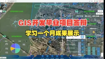
湖北大学第6组GIS开发毕业实习项目答辩:智慧城市-武汉;学习一个月成果展示
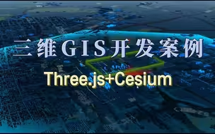
三维GIS开发案例|cesium+three.js;智慧城市/数字孪生/智慧交通/实景三维;零基础学三维GIS开发,系统学习+就业推荐;
无需建模!Cesium根据数据直接生成管道模型!
地信就业|GIS值钱的是信息系统,说白了就是编程;它是转软件最好的一个跳板;地信/测绘/遥感/资源与环境
GIS开发 | 基于VUE+Mapbox技术栈,实现共享电动车管理系统平台,可用于毕设项目参考
WebGIS开源架构Openlayers零基础入门(十):在openlayers中使用canvans绘制图形的原理
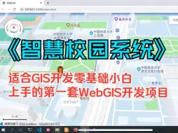
《智慧校园系统》|GIS开发零基础小白适合入手的第一个WebGIS开发项目,地信/测绘/遥感/资源与环境/人文地理与城乡规划等;无偿分享完整版视频教程+源码笔记
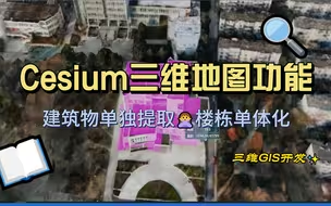
GIS开发入门 | Cesium三维地图功能展示;三维WebGIS开发必学开源地图框架;智慧城市/数字孪生/实景三维/智慧交通
GIS开发教程 |1小时快速入门openlayers二维web地图开发;webgis开发找工作必备技能;零基础学GIS开发;智慧城市/智慧交通/数字孪生
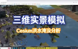
Cesium洪水淹没分析:三维实景模拟,WebGIS开发学习+就业
GIS开发项目|智慧交通项目演示;完整版项目教程无偿分享,零开发基础可学;可用作地信/测绘/遥感/城乡规划/资源与环境等专业WebGIS开发毕设项目参考
GIS开发教程|在地图框架mapbox中实现白天和黑夜自由切换的沙盘效果;零基础学webgis开发;地信/测绘/遥感/城乡规划
GIS开发入门教程|cesium坐标转换-经纬度坐标与转笛卡尔坐标之间的转换;三维GIS开发必学开发地图框架cesium教程;零基础学WebGIS开发三维方向
想转行做GIS开发,GIS行业有专业要求限制吗?测绘/城乡规划/土木工程/遥感/地信/土地管理/海洋技术/web前端
太酷了,这就是你要的three.js大屏效果
前端webgis开发入门实践教程:从开发原理入门到项目开发实践;零基础可学;适合地信/测绘/遥感/水利水电/城乡规划等专业想从事GIS开发的零基础人员
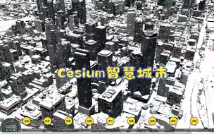
Cesium之智慧城市
UE5徐州市数字孪生日景-简介附下载
GIS技能大赛优秀作品|操作赛道矢量制图方向:开封市国潮主题地图册;地信/测绘/遥感/城乡规划/资源与环境等专业加分/考研必看
三维GIS开发/数字孪生/智慧城市项目学习,真实项目中设计稿交付 Cesium+WebGL+Shader+Echarts实战应用
GIS开发项目答辩|兰州交通大学第二组实训答辩-项目演示+功能介绍+项目功能解读;可做webgis毕设项目参考;零基础可学;地信/测绘/遥感/城乡规划/资源环境
GIS开发项目答辩|地质大学15天学习成果展示;web前端基础+mapbox+L7框架;零基础学习GIS开发助力GIS竞赛/考研/就业
湖北大学GIS开发项目答辩:GIS开发项目实训一个月学习成果展示;零基础学GIS开发
GIS开发学习一个月项目成果展示:湖北大学地信专业2001班第一组智慧城市项目答辩;可写入简历;可做毕业参考的项目
WebGIS开发入门自学教程|智慧机场项目;提供完整版视频教程+源码笔记;webgis毕设/课设项目参考
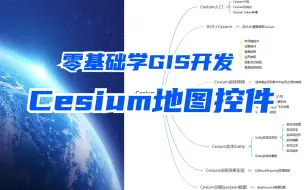
Cesium零基础入门教程|cesium基础学习,地图控件介绍;三维GIS开发必学开源地图框架;找GIS开发工作必备开发技能cesium技术;地信/测绘就业
WebGIS开发 | 基于Vue+OpenLayers/Mapbox全流程开发,智慧交通系统事件查询功能展示
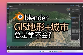
【教程】终于学会!100%可用GIS+Blender制作地形和城市建筑模型,blosm插件安装到使用。blenderOSM插件,鼠标跟随录屏
mapbox零基础教程:相机功能(俯仰角+水平角)及沙盘效果的实现;GIS开发必学地图框架
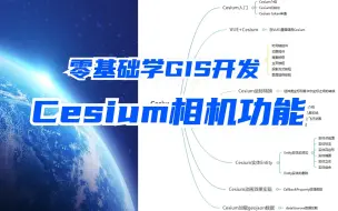
cesium相机功能介绍,常用三种相机定位跳转功能介绍:setview/flyto/ lookat通过定义相机目的地/视角定义相机目的地(方向),跳转到目的地
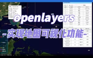
GIS开发入门|openlayers实现地图可视化功能;webgis开发必学开源框架;智慧城市/智慧交通/地图可视化/Web前端
Cesium零基础教程 | Cesium基本介绍+版本选择+token申请;零基础学三维GIS开发;地信/测绘/遥感/城乡规划/水利水电
华农学生GIS开发实训项目答辩-智游江城|GIS开发项目零基础课程,助力GIS考研/GIS就业/GIS竞赛;地信、测绘、遥感、城乡规划、资源与环境
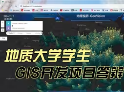
GIS大赛作品分享|二三维一体化自建房安全隐患检测系统管理平台(源自地质大学(武汉)优秀学员);本视频仅用于学习分享交流,助力GIS大赛、GIS考研/面试加分
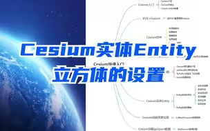
cesium入门教程|cesium中实体entity立方体的设置;长方体/椭圆的设置;提供完整版入门教程+视频源码;三维GIS开发必学框架
GIS教程|GIS项目完整版开发流程;零基础学GIS开发;